Coverage Area Selection Guide
The Coverage Area feature allows you to define the geographic region for your services, whether by county or zip code. This guide will take you through the process step-by-step.
How to Select Your Coverage Area in ServeManager
- Log into Your ServeManager Account: Log into your ServeManager account using your credentials.
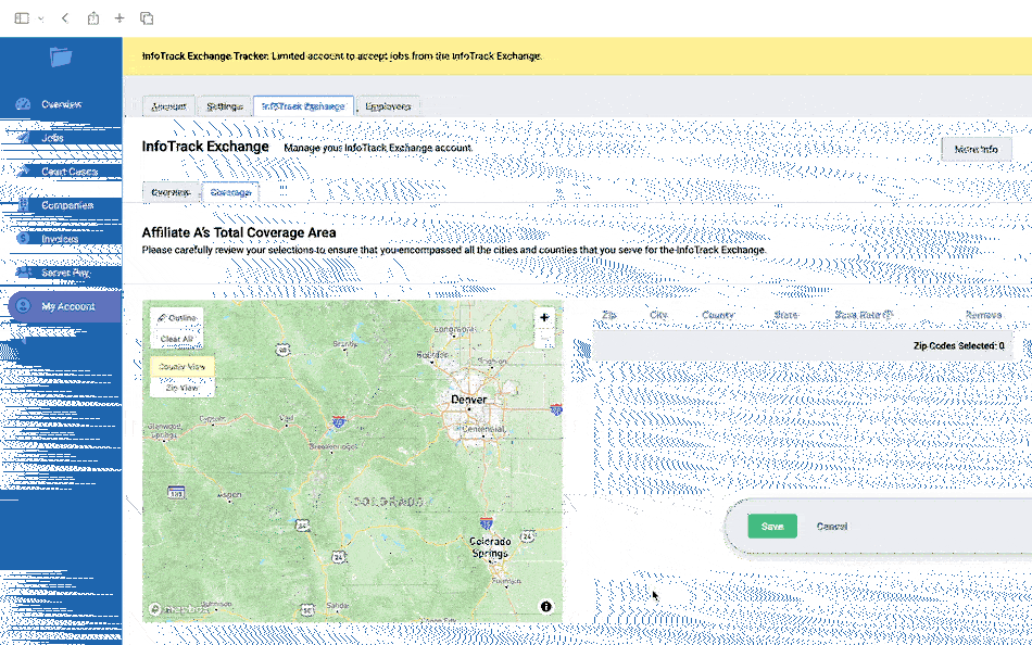
- Navigate to the Coverage Area Feature: Click on the “My Account” link located in the sidebar of the main interface. From there, click on the “InfoTrack Exchange” tab. Finally, click on the “Coverage” tab to access the interactive map.
- Understand the Map Controls: Before selecting your Coverage Area, familiarize yourself with the map controls. They include:
- County View: This button switches on the county view, displaying county boundaries. The county view is activated by default when you access the map.
- Zip View: This button switches on the zip code view, displaying zip code boundaries.
- Outline: This button toggles the Outline tool on and off, enabling you to select zip codes by tracing an outline on the map.
- Clear All: This button removes all current selections on the map.
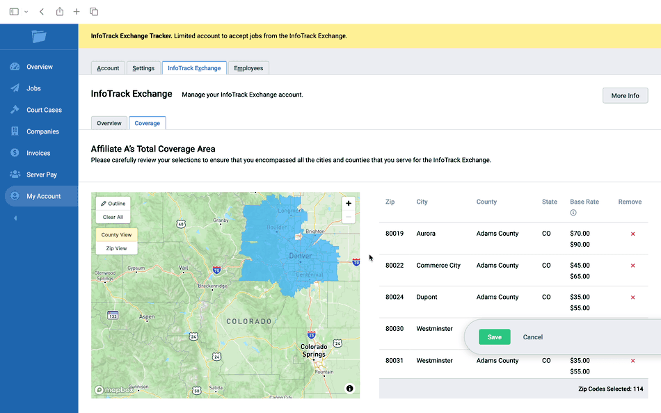
- Select Your Coverage Area: With the County View on by default, start selecting your Coverage Area by clicking on the counties of your choice. They will highlight to indicate selection and appear on the list of selected zip codes to the right of the map.
- Switch to the Zip View If Needed: If you need to select individual zip codes, click on the “Zip View” button. This will display zip code boundaries on the map. Just like with counties, click on the zip codes you want to select.
- Deselect Areas: To deselect a county or zip code, click on it again on the map or locate it in the list of selected areas and click the “Remove” button next to it. Note that deselecting a county will also deselect any zip codes within that county.
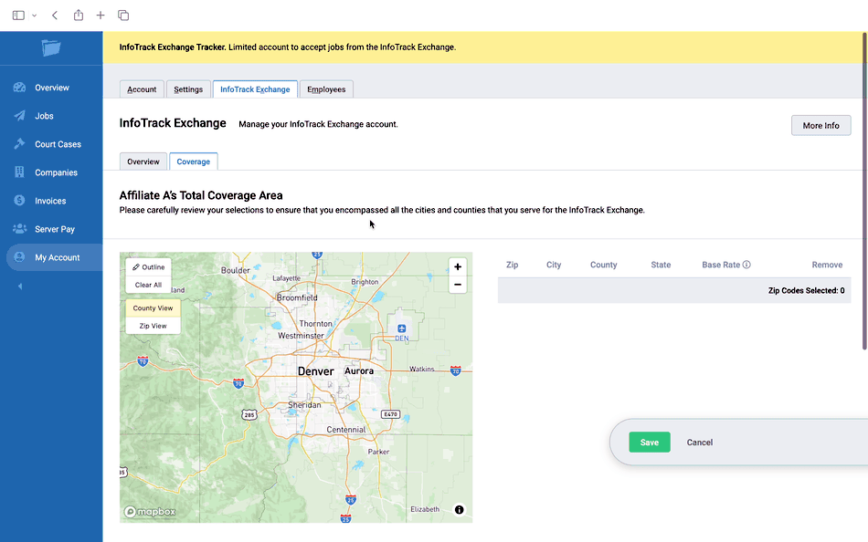
- Use the Outline Tool: To use the Outline tool, click on the “Outline” button on the map controls. Then, click multiple times on the map to trace your desired selection area, ending with a double click to complete your outline. The map will select all zip codes or counties that fall within the traced area, depending on which view is active. When you’re finished, click the “Outline” button again to turn the Outline tool off.
- Clear All Selections If Needed: If you want to start over with your selections, use the “Clear All” button. This will remove all current selections, allowing you to start fresh.
- Save Your Selections: Once you’ve finished selecting your Coverage Area, click the “Save” button located on the right side of the page. This will save your Coverage Area based on your selections.
That’s it! You have successfully set up your Coverage Area in ServeManager. By following these steps, you can tailor your services to specific geographic regions. Remember to update your Coverage Area as your service region expands or changes.